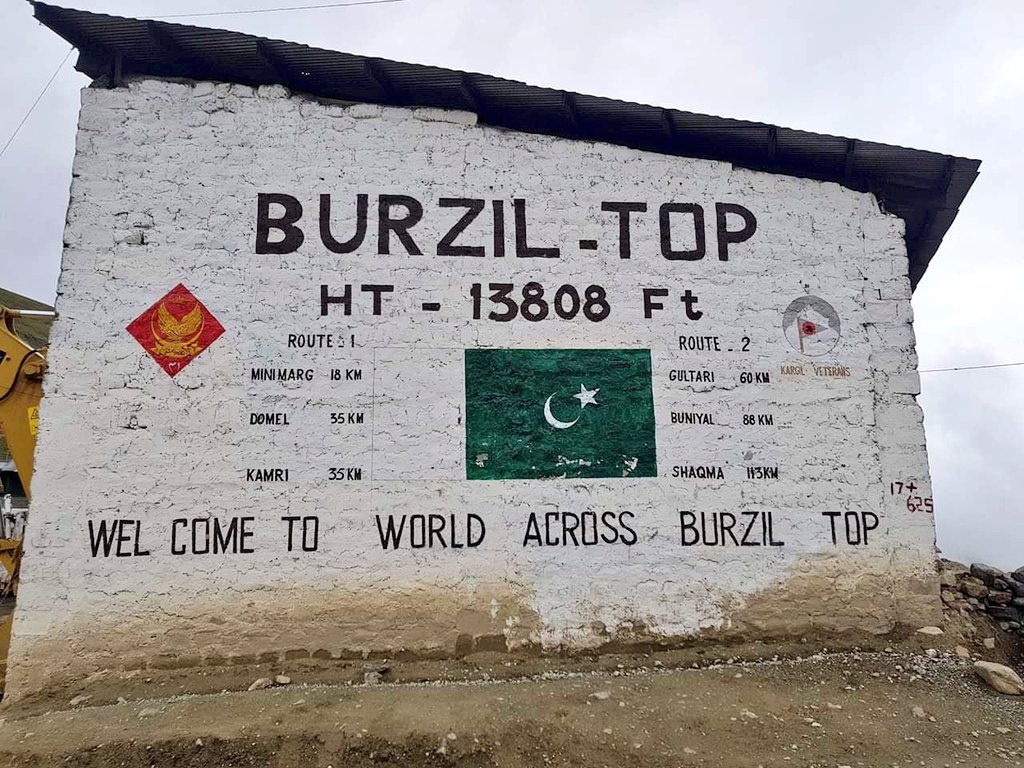
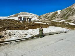
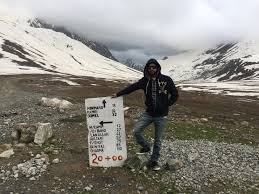
Tucked away in the mesmerizing wilderness of northern Pakistan, Burzil Pass serves as a breathtaking high-altitude gateway connecting the Astore Valley of Gilgit-Baltistan with Minimarg and historically extending toward the Kashmir region. Located at an elevation of approximately 4,100 meters (13,451 feet), this strategic mountain pass offers more than just rugged beauty. It is steeped in military, historical, and cultural relevance. A hidden treasure for geographers, trekkers, and adventure-seekers, Burzil Pass presents panoramic views, dramatic landscapes, and an untouched ecosystem that remains off the beaten tourist track. Despite its remoteness, the pass continues to attract intrepid travelers eager to discover its mysterious aura and historical importance. Whether you are an academic researching ancient trade routes or an explorer in search of raw mountain beauty, Burzil Pass holds an unparalleled allure. This guide explores every aspect of Burzil Pass—from its historical roots to travel logistics—offering a deep and practical understanding of this awe-inspiring location.
A Passage Through Time: The Historical Significance of Burzil Pass
Historically, Burzil Pass played a crucial role in the regional dynamics of South Asia, especially during the Dogra rule in the 19th century. As part of the old route connecting Srinagar in Kashmir to Gilgit, the pass served both commercial and military purposes. British colonial officers, geographers, and traders used this pass extensively. It was particularly relevant during the days of the Great Game, when the British and Russian empires competed for control in Central Asia. Fortified outposts and caravan shelters—remnants of which still exist near the pass—highlight its once-vital role. It also featured in World War II strategies and later border monitoring due to its proximity to the Line of Control (LoC). The pass today, though no longer an active trade corridor, carries within its rocks and ridges stories of ancient footfalls, military maneuvers, and cross-cultural exchanges. Understanding the historical context adds depth to the travel experience, allowing visitors to reflect on Burzil not just as a scenic site, but as a living monument of shifting borders and bygone empires.

Access and Transportation: Getting to Burzil Pass
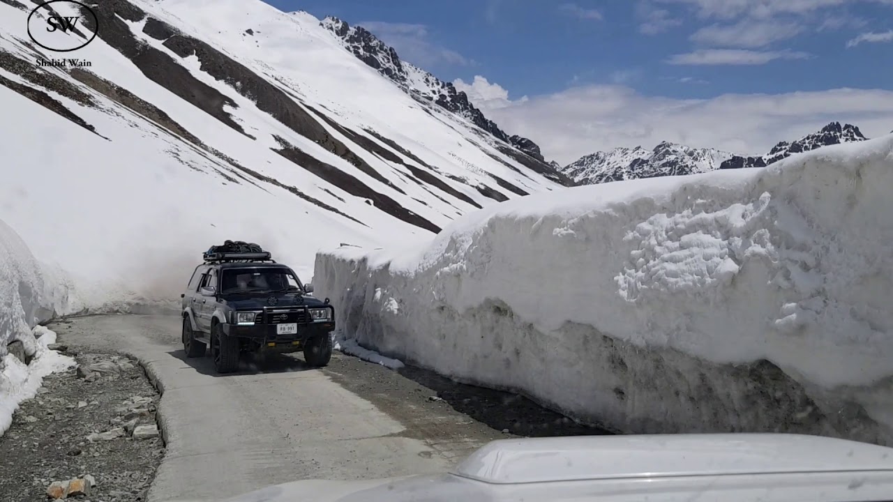
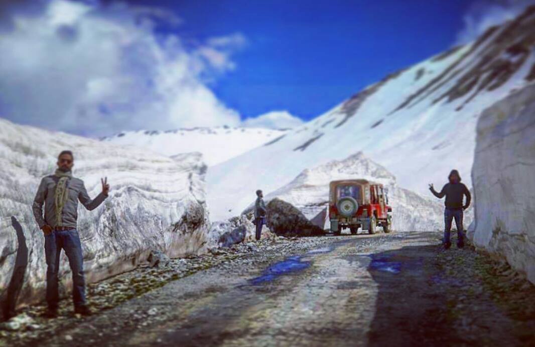
Reaching Burzil Pass requires resilience, planning, and a love for off-road adventure. The pass lies approximately 80 kilometers southeast of Astore town, accessible via Minimarg—a serene valley known for its pine forests and alpine meadows. The journey typically begins in Gilgit, with a road trip of roughly 7–8 hours to Astore. From there, 4×4 vehicles are mandatory, as the terrain becomes rugged, narrow, and often weather-worn. The road is only open from June to September, as snow renders the route impassable during the rest of the year. Permits are also required for foreign travelers, as this region is close to sensitive border areas. The Pakistani Army maintains checkpoints and offers guidance in the region, ensuring safety and regulation. Although there is no public transport to Burzil Pass, local tour operators and jeeps can be hired in Astore or Gilgit. Travelers should plan for early departures, carry fuel reserves, and prepare for a journey that is as much about the drive as the destination.
Geographical Importance and Strategic Location
Geographically, Burzil Pass is a vital corridor in the western Himalayas, linking the Deosai Plateau and Minimarg with Kashmir’s northern stretches. It forms part of the Himalayan orogenic belt, characterized by tectonic uplift, glacial activity, and alpine topography. This makes it a prime site for geological studies, particularly concerning Himalayan mountain formation and erosion patterns. The pass serves as a watershed divide between the Indus and Neelum rivers, and lies in close proximity to important glaciers, including the Rama Glacier. Its strategic location also makes it a site of military relevance, patrolled routinely due to its proximity to the LoC. From a trekking and ecological standpoint, Burzil Pass is unique because it transitions from forested slopes in Minimarg to barren, snow-covered heights. This drastic change in topography within a short radius makes it ideal for understanding high-altitude ecosystems, microclimates, and watershed management. As such, Burzil Pass is not just a scenic route but a geographical keystone in the broader Himalayan landscape.
Weather Conditions and Best Time to Visit

Weather at Burzil Pass is harsh, unpredictable, and highly altitude-dependent. Summers (June–September) are the only viable window for travel, offering daytime temperatures between 5°C and 15°C. However, temperatures can drop sharply after sunset, sometimes nearing freezing even in July. The pass receives heavy snowfall from October through May, often over 10–15 feet, cutting off access and turning the route into a snowbound fortress. Sudden snowstorms and landslides are common, especially in shoulder months (May and September). Monsoon influence is minimal due to the pass’s high elevation and interior location, but local cloudbursts can still cause travel delays. It’s advisable to check weather forecasts through Pakistan Meteorological Department and consult local guides before embarking. UV radiation is strong at this altitude, so sun protection is essential. Weather patterns here shift quickly, and travelers should be prepared for snow, wind, and sun—all in a single day.
Language and Communication Barriers
The communities around Burzil Pass, particularly in Minimarg and Astore, primarily speak Shina, a Dardic language indigenous to Gilgit-Baltistan. Urdu, Pakistan’s national language, is widely understood, especially among younger generations and officials at checkpoints. English is rarely spoken outside major towns like Gilgit. For travelers, this language gap can present challenges, especially in rural settings where signage is minimal and directions may be oral and vague. Learning a few Shina or Urdu phrases can be extremely helpful in gaining local trust and navigating smoothly. Mobile coverage is patchy at best, and internet access is nearly non-existent near the pass. Satellite phones or offline maps are recommended. Despite communication barriers, locals are generally warm and hospitable, often helping travelers with gestures and goodwill. Hiring a local guide who speaks Shina or Urdu is highly recommended to bridge the linguistic gap and enhance the overall experience.
People and Culture of the Region
The people living near Burzil Pass, primarily in Minimarg, Domel, and Astore, belong to indigenous communities with deep-rooted traditions. These populations have historically lived off the land through pastoralism, farming, and forestry. Their culture is influenced by Dardic, Balti, and Kashmiri heritage, visible in local dress, music, and oral storytelling. Religious life is predominantly Shia Islam, with strong communal values and reverence for nature. Seasonal festivals, such as Navroz (spring celebration) and traditional marriage ceremonies, are vibrant yet private affairs. The architecture is basic—often stone and wood homes suited to high-altitude living. Despite the ruggedness of life, hospitality is a core value, and visitors often receive tea, bread, or shelter even without asking. Social life revolves around family, livestock, and storytelling during long winter months. Travelers interested in ethnography or cultural anthropology will find the region around Burzil Pass rich in unwritten history, preserved through generations of oral transmission.
Flora and Vegetation of Burzil Region
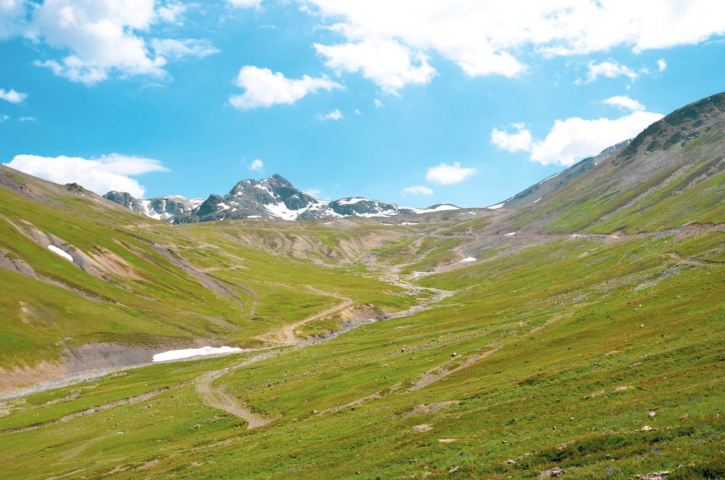
Despite its alpine altitude, Burzil Pass and its surrounding valleys host diverse vegetation, particularly in the transitional zones leading to Minimarg and Deosai. The lower slopes are blanketed in pine, fir, and juniper forests, while the meadows bloom with wildflowers like edelweiss, gentians, and primula in summer. At higher elevations, the flora becomes sparse, consisting of alpine shrubs, mosses, and lichens that thrive in rocky, wind-swept terrain. This unique blend makes the region ecologically important. The Deosai plains nearby are home to the Himalayan brown bear, while local herbs are used for medicinal purposes by native healers. Botanists and researchers often visit this region to study plant adaptation in extreme climates. However, climate change is visibly impacting vegetation zones, with certain flower species retreating higher each year. Tourists are urged not to pluck wildflowers or disturb fragile ecosystems, as much of the vegetation is endemic and vital for ecological balance.
Culinary Landscape and Local Cuisine
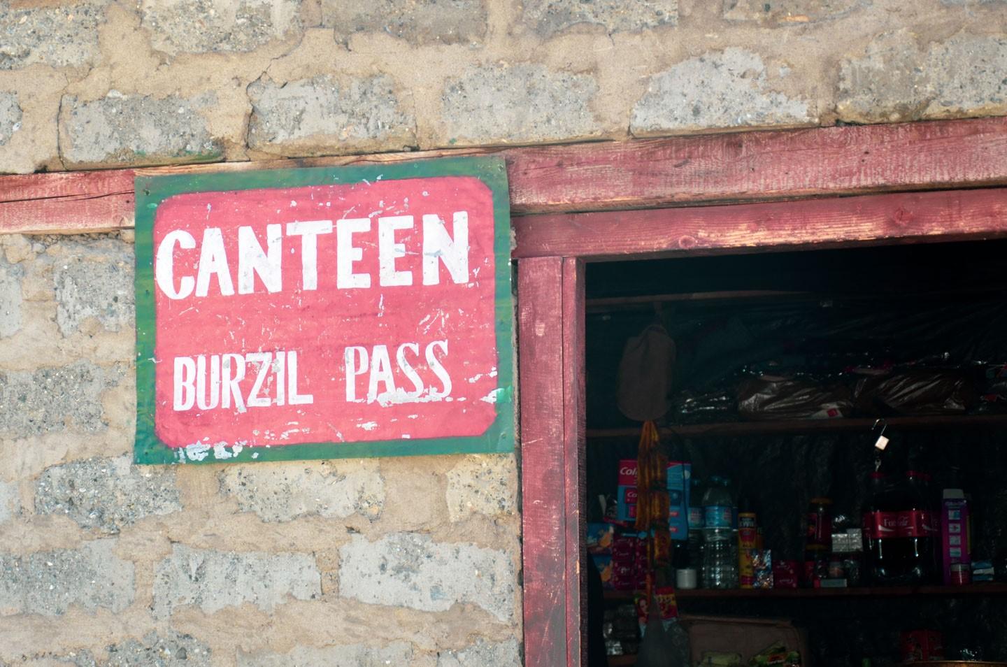
The cuisine around Burzil Pass is a blend of Astore, Balti, and Kashmiri culinary traditions. Meals are simple, hearty, and tailored to cold mountain climates. The staple dish is “Chapshuro”, a meat-filled flatbread, often served with salty yak butter tea. Lentils, barley, and dairy products form the base of daily meals. In colder months, locals prepare “Skardu soup”, made from flour, water, and meat broth, rich in calories and warmth. Another popular item is “Qahwa”, a green tea infused with cardamom, served with dried apricots or walnuts. Fresh produce is limited at higher altitudes, but lower valleys provide potatoes, turnips, and apples. Tourists may not find restaurants near Burzil Pass itself, so it’s advisable to carry non-perishable food or request meals in local homes or guesthouses in Minimarg or Domel. The hospitality of locals often includes shared meals, offering an authentic taste of mountain life.
Major Travel Routes and Itinerary Planning
The most common travel route to Burzil Pass begins in Islamabad, moving north via the Karakoram Highway (KKH) to Gilgit, then eastward to Astore, and onward to Minimarg. The final stretch to Burzil is a challenging off-road drive requiring 4WD vehicles and experienced drivers. Alternative access via Skardu and Deosai National Park is scenic but only advisable in mid-summer due to unpredictable road conditions. Ideal itineraries include a 3–5 day plan, with stops at Rama Lake, Minimarg Meadows, and possibly Deosai Plains if weather permits. Each stop provides not only rest but also breathtaking photographic opportunities. Booking accommodations in Astore or Chilum check post is recommended in advance. Always factor in altitude acclimatization and potential delays due to weather or road conditions. Tour operators based in Gilgit and Islamabad offer customized packages for Burzil-bound travelers, often including permits, transport, and local guides.
Recommendations for Travelers to Burzil Pass
To make the most of a trip to Burzil Pass, prioritize safety, preparedness, and cultural respect. Always check the security advisory and weather forecast before departure. Travel in groups if possible, and carry extra fuel, spare tires, and a basic toolkit. Hiring a local guide adds immense value—not just for navigation, but also for cultural interaction and insider knowledge. Stick to marked paths and avoid venturing near military areas or restricted zones. Practice Leave No Trace principles: pack out what you pack in, and avoid disturbing wildlife or locals. Interact respectfully, dress modestly, and seek permission before photographing people or their homes. Consider visiting nearby Minimarg Lake or Deosai Plateau for added adventure. The best experiences often come from immersing in local life, so take time to pause, reflect, and appreciate the isolation that makes Burzil Pass so unique.
Essential Packing Guidelines for High-Altitude Travelers
Packing for Burzil Pass requires attention to altitude, remoteness, and climate variability. Begin with layered clothing: thermal inners, fleece jackets, waterproof shells, and insulated outerwear. Footwear should be sturdy, waterproof hiking boots. Include UV sunglasses, SPF 50 sunscreen, lip balm, woolen gloves, and beanies. A good-quality sleeping bag rated for -10°C is essential if you plan to camp. Carry water purification tablets, high-energy snacks, and ready-to-eat meals. Power banks, offline maps, and emergency medical kits (including altitude sickness medication) are non-negotiable. A small first aid kit with antiseptics, bandages, and pain relievers is a must. Also pack travel permits, multiple ID copies, and extra cash, as ATMs are unavailable beyond Astore. If you plan to document your trip, carry backup storage and waterproof covers for your gear. A reusable water bottle and trash bags contribute to eco-responsible travel. Preparedness ensures your focus remains on enjoying the majestic beauty of Burzil Pass.
Frequently Asked Questions (FAQs) About Burzil Pass
1. Is Burzil Pass open year-round?
No, it is only accessible from June to September due to heavy snow in the off-season.
2. Do I need a permit to visit Burzil Pass?
Yes, especially for foreigners, due to its proximity to sensitive border areas.
3. Can I camp at Burzil Pass?
Camping is possible, but only for experienced trekkers with proper equipment and weather awareness.
4. Is the road safe?
The road requires a 4×4 vehicle and experienced driver; it is rough but generally safe during summer.
5. Is Burzil Pass suitable for families?
Not recommended for children or elderly due to altitude and rugged conditions.
6. Are there any hotels nearby?
Basic guesthouses exist in Astore and Minimarg, but no hotels near the pass itself.
7. Can I hire local guides?
Yes, and it’s highly recommended to enhance safety and cultural understanding.


