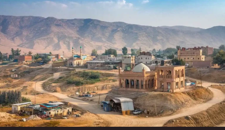
Introduction to Khuzdar, Balochistan
Khuzdar, nestled in the rugged heart of Balochistan, is a city that quietly commands attention. With its dramatic mountain landscapes, centuries-old tribal heritage, and strategic location along Pakistan’s national highway network, Khuzdar is more than just a waypoint—it’s a cultural and historical crossroads waiting to be explored. As the second-largest city in Balochistan and the administrative capital of Khuzdar District, it offers a compelling blend of natural beauty, historical depth, and emerging urban vitality.
Historical Overview
The history of Khuzdar is layered with the footprints of empires, mystics, and monarchs. The city’s name is believed to derive from Persian and Arabic roots—“Qaz” meaning silk and “Dar” meaning place, or alternatively “Khuz” (to possess) and “Dar” (territory), suggesting a land held firmly by its people. Historically known as “Qazdar” and “Jhalawan,” Khuzdar has been shaped by the Tooranians of Central Asia, the Mauryan Empire of India, and the Brahman rulers of Sindh.
Arab rule arrived in the 7th century, transforming Khuzdar into a spiritual and administrative center. The Ghaznavid dynasty later absorbed the region, followed by the Khanate of Kalat, which made Khuzdar the capital of the Jhalawan Kingdom in the 17th century. British colonial forces established a political agency here in 1903, and after Pakistan’s independence in 1947, Khuzdar became the district headquarters of the Balochistan States Union. It was later designated the capital of Kalat Division in 1955 before becoming an independent district in 1974.
This historical trajectory has left Khuzdar with a rich tapestry of cultural influences, visible in its architecture, tribal structures, and spiritual landmarks.
Geographical Location and Strategic Significance
Khuzdar is located at an elevation of approximately 4,058 feet above sea level, surrounded by the Khuzdar Hills and part of the central Brahui-speaking belt of Balochistan. The city lies along the N-25 National Highway, which connects Karachi to Chaman and serves as a key artery in the China-Pakistan Economic Corridor (CPEC). This strategic position makes Khuzdar a vital transit hub linking southern Pakistan to Iran, Afghanistan, and Central Asia.
The district borders several key regions, including Awaran, Kalat, Lasbela, Bolan, Kharan, and Jhal Magsi, as well as the Sindh districts of Larkana and Naushahro Feroze. This geographical placement has historically made Khuzdar a center for trade, migration, and cultural exchange.
Cultural Background
Khuzdar is home to a diverse array of Baloch tribes, including the Bizenjo, Hasni, Zehri, Mengal, Nausherwani, Zarakzai, Ahmadzai, and Kurd. These tribes have preserved their customs, languages, and governance structures for centuries, contributing to the city’s strong sense of identity and community.
The dominant language is Brahui, though Balochi and Urdu are widely spoken. Tribal traditions such as jirgas (councils), folk music, and oral storytelling remain integral to daily life. Visitors will find that hospitality is not just a custom—it’s a deeply held value. Tea, dates, and stories are generously shared, and guests are treated with respect and curiosity.
Religious life in Khuzdar is centered around mosques and shrines, with Sufi influences visible in spiritual practices and architecture. The city’s spiritual landscape includes sites like the Faizan-e-Aulia Mosque and the nearby shrine of Bilawal Shah Noorani in Lahoot Lamakan.
Economic Relevance
Khuzdar’s economy is a mix of agriculture, mining, and public sector employment. The region produces rice, wheat, cotton, mangoes, and dates, though agriculture remains limited due to arid conditions. More significantly, Khuzdar is rich in natural resources, including barite, chromite, and onyx, which are mined and exported to other parts of Pakistan and abroad.
The city is also home to the Balochistan University of Engineering and Technology (BUET), which attracts students and researchers from across the province. This academic presence has helped foster a growing middle class and increased demand for infrastructure, hospitality, and services.
With its strategic location on the CPEC route, Khuzdar is poised for economic expansion. Road connectivity, mineral wealth, and educational institutions are driving investment and development, making it an increasingly important city in Balochistan’s future.
Transportation in Khuzdar
Khuzdar’s strategic location in central Balochistan makes it a vital transit hub for travelers moving between southern Pakistan, the Afghan border, and the Iranian frontier. Whether you’re arriving from Karachi, Quetta, or further afield, Khuzdar offers multiple transportation options—each with its own advantages and challenges.
Reaching Khuzdar by Air
Khuzdar does not currently have a commercial airport. The nearest operational airports are:
- Quetta International Airport (QUET): Approximately 400 km north of Khuzdar. Offers domestic flights to Karachi, Islamabad, Lahore, and Peshawar.
- Karachi Jinnah International Airport (KHI): Roughly 360 km south of Khuzdar. Serves as Pakistan’s largest airport with extensive domestic and international connectivity.
- Mohenjodaro Airport (HDD): Located about 160 km southeast, though limited in commercial operations.
From these airports, travelers typically continue to Khuzdar via road. Private taxis, intercity buses, and rental cars are available at all major terminals. For researchers or business travelers, hiring a driver familiar with Balochistan’s terrain is highly recommended.
Road Transportation
Khuzdar is located along the N-25 National Highway, also known as the RCD Highway (Regional Cooperation for Development), which connects Karachi to Chaman and Quetta. This highway is a key segment of the China-Pakistan Economic Corridor (CPEC), making Khuzdar a critical junction for trade and logistics.
- From Karachi: The drive takes approximately 7–8 hours, passing through Lasbela and Wadh. The route features winding mountain roads, scenic valleys, and occasional checkpoints.
- From Quetta: The journey spans about 6–7 hours, with stops in Kalat and Mastung. The road is paved but can be affected by weather and landslides.
- From Larkana (Sindh): A western tributary connects Larkana to Khuzdar, offering an alternative route for travelers from interior Sindh.
Bus services such as Al Saeed Coaches and Baloch Transport operate daily routes between Khuzdar and major cities. These buses range from economy to semi-luxury, with onboard refreshments and rest stops. Private vehicles and 4x4s are preferred for flexibility and comfort, especially for families or research teams.
Train Connectivity
Khuzdar does not have a railway station. The nearest railheads are located in:
- Quetta: Connected to Pakistan’s national rail network, including routes to Lahore, Karachi, and Peshawar.
- Jacobabad and Larkana: Offer limited rail services to Sindh and southern Punjab.
Travelers arriving by train must transition to road transport to reach Khuzdar. This lack of rail infrastructure reflects broader challenges in Balochistan’s connectivity, though future development under CPEC may address this gap.
Local Transportation Within Khuzdar
Navigating Khuzdar is relatively straightforward. The city’s layout includes a central bazaar, administrative zones, and residential neighborhoods spread across a valley surrounded by hills. Local transport options include:
- Rickshaws: Widely available and affordable. Ideal for short distances and market visits.
- Taxis: Operate on fixed or negotiable fares. Recommended for longer trips or evening travel.
- Shared Vans: Used by locals for commuting between neighborhoods and nearby villages.
- Motorbikes: Common among residents. Rentals are rare but possible through informal arrangements.
Walking is feasible in central areas, especially around the bazaar and university. However, due to elevation and heat, travelers should avoid long walks during midday hours.
Travel Tips and Recommendations
- Fuel and Supplies: Fuel stations are available along major routes, but it’s wise to fill up before entering remote stretches. Carry water, snacks, and a first-aid kit.
- Weather Considerations: Travel during cooler months (October–March) for comfort and safety. Avoid monsoon season due to potential road damage.
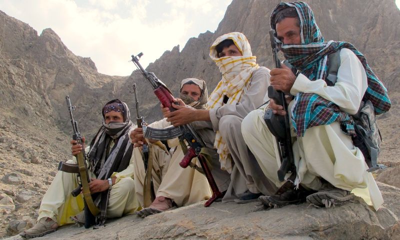
- Security: While Khuzdar is generally safe, travelers should stay updated on local advisories and avoid isolated areas after dark. Registering with local authorities or staying in contact with hosts is advisable.
- Navigation: Mobile networks like Jazz and Zong offer coverage in Khuzdar, but signal strength may vary. Offline maps and GPS devices are useful for rural exploration.
Khuzdar’s transportation network, though limited in some areas, offers enough flexibility for adventurous travelers, cultural researchers, and logistical planners. With proper preparation and local insight, the journey to and within Khuzdar becomes a rewarding part of the travel experience.
Khuzdar Fort
Khuzdar Fort stands as a silent sentinel over the city, perched atop a rugged hill that overlooks the valley below. This ancient stronghold is not only a symbol of Khuzdar’s resilience but also a living archive of its layered history. With panoramic views, architectural intrigue, and cultural depth, the fort is one of the most compelling destinations for travelers seeking to understand the soul of Balochistan.
Historical Context
The origins of Khuzdar Fort trace back to pre-Islamic times, when the region was governed by Brahman rulers and later absorbed into the Mauryan Empire. Over centuries, the fort evolved under various dynasties, including the Ghaznavids, the Khanate of Kalat, and eventually the British colonial administration. Each era left its imprint—whether in the form of reinforced walls, watchtowers, or administrative quarters.
During the 17th century, Khuzdar became the capital of the Jhalawan Kingdom, and the fort served as its military and political nucleus. Tribal leaders and governors used it as a base to oversee trade routes, settle disputes, and defend against invasions. In the colonial period, the British repurposed the fort as a garrison and intelligence post, adding stone barracks and signal stations.
Today, the fort remains a symbol of continuity, linking Khuzdar’s ancient past with its modern aspirations.
Architectural Features
Khuzdar Fort is built primarily from locally sourced stone and mud-brick, with thick ramparts designed to withstand both natural and human threats. The structure includes:
- Outer Walls: Fortified with battlements and narrow slits for archers.
- Main Gate: A heavy wooden entrance reinforced with iron studs, opening into a central courtyard.
- Watchtowers: Positioned at strategic corners, offering 360-degree views of the surrounding terrain.
- Barracks and Quarters: Remnants of living spaces used by soldiers and administrators.
- Prayer Area: A small mosque within the fort, reflecting the spiritual life of its inhabitants.
The design reflects a blend of tribal pragmatism and colonial engineering, with minimal ornamentation but maximum functionality.
Visitor Experience
Exploring Khuzdar Fort is a journey through time. As you ascend the hill, the city recedes into a mosaic of rooftops and orchards, while the fort’s silhouette grows more imposing. The climb is moderately steep but manageable, and the path is lined with wild shrubs and occasional stone markers.
Inside the fort, visitors can wander through open courtyards, climb watchtowers, and examine weathered inscriptions on stone walls. Local guides often share stories of tribal battles, ghost legends, and political intrigue, adding a layer of folklore to the historical narrative.
- Best time to visit: October to March, when temperatures are mild and skies are clear.
- Recommended gear: Comfortable walking shoes, sun protection, water bottle, camera.
- Entry fees: None; donations to local preservation efforts are appreciated.
- Accessibility: Reachable by car or rickshaw from Khuzdar city center; final approach requires a short hike.
Photography Tips
Khuzdar Fort offers exceptional photography opportunities, especially during golden hour. Key spots include:
- Watchtower Views: Capture the cityscape and surrounding hills.
- Stone Archways: Frame shots with natural light and shadow.
- Courtyard Panoramas: Use wide-angle lenses to document the spatial layout.
- Textural Details: Focus on weathered stone, carvings, and moss-covered walls.
Drone photography is possible with permission from local authorities, but standard handheld shots are more than sufficient to capture the fort’s grandeur.
Cultural Significance
The fort is deeply embedded in local identity. It’s not just a relic—it’s a symbol of Khuzdar’s endurance, tribal unity, and strategic importance. Community elders often recount tales of tribal councils held within its walls, and schoolchildren visit the site as part of heritage education programs.
During festivals and national holidays, the fort becomes a gathering place for cultural performances, poetry readings, and flag-raising ceremonies. Its presence in local art, music, and storytelling reinforces its role as a cultural anchor.
Preservation and Challenges
Khuzdar Fort faces threats from erosion, neglect, and urban encroachment. While some restoration efforts have been initiated by local NGOs and heritage advocates, formal conservation remains limited. Visitors can support preservation by respecting the site, avoiding littering, and sharing their experiences to raise awareness.
Researchers and historians continue to study the fort’s architecture and inscriptions, hoping to uncover more about its origins and evolution. The site holds potential for archaeological excavation and digital documentation, which could further enrich Balochistan’s historical record.
Chota Chotok (Moola Chotok)
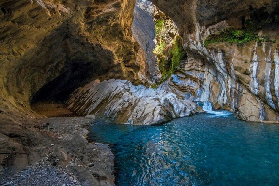
Hidden within the rugged folds of the Khuzdar District lies Chota Chotok, locally known as Moola Chotok—a pristine ravine carved by waterfalls, cliffs, and the winding Moola River. Revered by adventurers and nature lovers alike, this secluded paradise offers a rare glimpse into Balochistan’s untouched wilderness. With its cascading waters, towering rock formations, and ethereal silence, Chotok is one of Pakistan’s most mesmerizing natural destinations.
Geographical and Cultural Context
Chotok is located in Moola Tehsil, approximately 80–105 kilometers northeast of Khuzdar city. The name “Chotok” translates to “falling water” in Brahui and Balochi, a fitting tribute to the waterfall that defines the landscape. The surrounding valley, known as Moola, is home to ancient ruins from civilizations dating back over 2,000 years, including Thorekhear, Hatachi, Hayrav, Kial Beig, and Pasta Khan.
The Moola River flows year-round through the valley, sustaining local agriculture and wildlife. The region is inhabited by Brahui-speaking communities who maintain traditional lifestyles, including fishing, farming, and oral storytelling. The cultural fabric of Moola is tightly woven with reverence for nature, making Chotok not just a scenic site but a spiritual one.
Natural Features and Landscape
Chota Chotok is defined by its dramatic topography:
- Waterfalls: The main waterfall cascades between two cliffs, forming a natural umbrella-like shape due to the interaction of mountain peaks.
- Gorges and Ravines: Narrow pathways and deep crevices create a labyrinth of stone and water, ideal for exploration.
- Rock Formations: Eroded over centuries, the cliffs display unique textures and colors, especially during sunrise and sunset.
- Pools and Streams: Crystal-clear water collects in natural basins, offering spots for swimming, photography, and reflection.
The elevation of the valley is approximately 1,237 meters (4,058 feet), which contributes to its cooler microclimate compared to surrounding areas.
Visitor Experience
Reaching Chotok is an adventure in itself. The final 80–85 kilometers from Khuzdar require off-road travel through rugged terrain, with no hotels or grocery stores along the way. A 4×4 vehicle is essential, and local guides are highly recommended. Jeep rentals typically cost between PKR 12,000 to 15,000, including round-trip service from Khuzdar.
Once at the site, visitors can hike, camp, swim, and photograph the landscape. The area is remote and lacks commercial infrastructure, so travelers must bring their own food, water, clothing, and first-aid supplies. Camping is popular, especially among groups, and offers a chance to experience the valley’s serenity under a star-lit sky.
- Best time to visit: October to March for cooler weather and clearer skies.
- Recommended gear: Hiking boots, mosquito nets, sun protection, waterproof bags, camera.
- Mobile coverage: Limited; partial Ufone signal may be available.
- Safety tips: Travel in groups, inform local authorities of your itinerary, and avoid monsoon season due to flash flood risks.
Photography Tips
Chotok is a dream for landscape photographers. The interplay of water, stone, and light creates dramatic compositions:
- Golden Hour: Capture the waterfall’s glow against the cliffs at sunrise or sunset.
- Long Exposure: Use tripods to photograph flowing water with silky textures.
- Aerial Shots: Drones can reveal the full scale of the ravine, but permissions may be required.
- Macro Details: Focus on rock textures, water droplets, and native flora.
Due to the remote location, battery backups and waterproof gear are essential.
Ecological and Conservation Value
Chotok’s ecosystem includes salt mines, freshwater pools, and native plant species. The Moola River supports fish populations, making fishing a common pastime among locals. Mango, orange, lemon, and olive fields are found along the route, adding agricultural diversity to the region.
However, the site faces environmental pressures from unmanaged tourism, littering, and erosion. Conservation efforts are minimal, and travelers are urged to follow Leave No Trace principles. Local NGOs have called for formal protection of the valley to preserve its ecological and cultural integrity.
Cultural Significance
For the people of Moola, Chotok is more than a waterfall—it’s a sacred space. Stories of ancient tribes, spiritual encounters, and seasonal rituals are tied to the valley’s geography. Elders speak of the waterfall as a place of healing and reflection, and its presence in local poetry and song reinforces its symbolic power.
Visitors who engage respectfully with local communities often gain deeper insights into the valley’s meaning and history. Sharing meals, listening to stories, and observing traditions can transform a scenic visit into a cultural exchange.
Karkh Valley
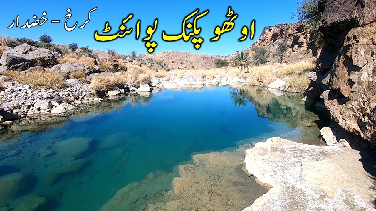
Karkh Valley, located approximately 80 kilometers east of Khuzdar city, is a lush and culturally vibrant region nestled within Karakh Tehsil. Known for its fertile lands, ancient settlements, and dramatic landscapes, Karkh offers a refreshing contrast to the arid terrain that dominates much of Balochistan. With its orchards, springs, and tribal legacy, the valley is a destination that appeals to both nature enthusiasts and cultural explorers.
Geographical Overview
Karkh Valley lies just off the M-8 Motorway, providing direct access to regional transportation routes and making it one of the more accessible rural destinations in Khuzdar District. The valley is surrounded by low hills and fed by seasonal streams that support agriculture and local biodiversity. Its coordinates—27.74028°N, 67.17500°E—place it in a transitional zone between the highlands of central Balochistan and the coastal plains to the south.
The valley’s elevation and water availability create a microclimate that supports fruit orchards, grazing lands, and native flora. Mangoes, lemons, oranges, and olives are cultivated here, contributing to the local economy and culinary identity.
Historical and Tribal Significance
Karkh has long been inhabited by Brahui-speaking tribes, including the Zehri, Mengal, and Bizenjo clans. These communities have preserved their customs through oral storytelling, seasonal festivals, and traditional governance structures. The valley is dotted with ancient ruins and burial sites, some dating back over a thousand years, though formal archaeological studies remain limited.
Local elders recount stories of tribal migrations, spiritual encounters, and battles fought to protect the valley’s resources. These narratives are passed down through generations and remain central to the region’s identity.
Karkh also played a role in regional trade, serving as a waypoint for caravans moving between Kalat, Lasbela, and the Sindh frontier. Its strategic location made it a site of both cooperation and conflict among neighboring tribes.
Natural Attractions
The valley’s natural beauty is one of its strongest draws. Key features include:
- Ozano Waterfall: Considered the highest waterfall in Balochistan, Ozano cascades down a cliff face surrounded by dense vegetation and rock formations. The site is popular for hiking, photography, and picnics.
- Seasonal Springs: Fed by underground aquifers, these springs emerge during the monsoon and winter months, creating temporary pools and wetlands.
- Orchards and Fields: Mango, lemon, and olive groves stretch across the valley, offering opportunities for agritourism and farm visits.
- Wildlife: The region supports foxes, wild goats, and migratory birds, making it a quiet haven for nature observation.
The landscape changes dramatically with the seasons—lush and green during winter and spring, dry and golden in summer. This variation adds to the valley’s visual and ecological richness.
Visitor Experience
Traveling to Karkh Valley requires a short drive from Khuzdar, typically 1.5 to 2 hours depending on road conditions. The route is paved but narrow, with occasional sharp turns and elevation changes. Local transport options include hired jeeps, taxis, and motorbikes.
Once in the valley, visitors can explore on foot, visit orchards, interact with local families, and hike to natural landmarks like Ozano Waterfall. Guided tours are available through community networks, though most experiences are informal and based on local hospitality.
- Best time to visit: November to March for cooler weather and active springs.
- Recommended gear: Hiking shoes, sun protection, water bottle, camera.
- Entry fees: None; some orchards may charge for guided tours or tastings.
- Mobile coverage: Available in central areas; patchy in remote zones.
Camping is possible in designated areas, though facilities are minimal. Travelers should bring their own supplies and coordinate with local hosts for safety and guidance.
Photography Tips
Karkh Valley offers diverse photography opportunities:
- Waterfall Shots: Use wide-angle lenses to capture Ozano’s full height and surrounding cliffs.
- Orchard Close-Ups: Focus on fruit clusters, leaves, and irrigation patterns.
- Tribal Portraits: With permission, document traditional attire and daily life.
- Landscape Panoramas: Sunrise and sunset provide dramatic lighting across the valley.
Drone photography is possible but should be done respectfully and with local approval.
Cultural Engagement
Visitors who take time to engage with Karkh’s residents often gain deeper insights into Balochistan’s tribal culture. Sharing meals, listening to stories, and participating in seasonal activities like harvesting or festivals can transform a scenic visit into a meaningful exchange.
The valley’s elders are often eager to share their knowledge, and younger residents may act as informal guides or translators. Respect for local customs—such as modest dress, polite conversation, and asking before taking photos—is essential.
Naal Valley
Naal Valley, located in the western part of Khuzdar District, is one of Balochistan’s most historically rich and geographically captivating regions. Known for its prehistoric archaeological site Sohr Damb, tribal heritage, and fertile landscape, Naal offers a rare convergence of ancient civilization and living culture. For travelers, researchers, and history enthusiasts, this valley is a gateway into the deep past of South Asia.
Historical and Archaeological Significance
Naal is most renowned for the archaeological site of Sohr Damb, also known as the Red Mound. Excavations at Sohr Damb have revealed evidence of the Amri-Nal culture, which flourished between 3800 BCE and 2300 BCE—predating the Indus Valley Civilization. The site has yielded distinctive pottery styles, including polychrome ceramics with figurative motifs, as well as early urban planning features such as mud-brick structures and burial chambers.
The first major excavation was led by Harold Hargreaves in 1924, followed by subsequent studies that confirmed the site’s importance in understanding prehistoric settlement patterns in Balochistan. Radiocarbon dating has placed many of the artifacts within the early Bronze Age, making Naal one of the oldest continuously inhabited regions in Pakistan.
In addition to Sohr Damb, the valley contains scattered ruins, dolmens, and underground water channels (karez systems), which reflect the ingenuity of ancient inhabitants in managing water and agriculture.
Geographical Overview
Naal Valley spans approximately 1,791 square kilometers and sits at coordinates 27.686°N, 66.188°E. The valley is surrounded by low hills and fed by seasonal streams, creating a fertile basin ideal for agriculture and livestock. Its elevation and location within the Kalat Division give it a moderate climate compared to the surrounding arid zones.
The landscape is dotted with date palms, wheat fields, and grazing lands, offering a tranquil setting for exploration and photography. The valley’s natural beauty is enhanced by its historical ambiance, making it a unique destination for slow travel and cultural immersion.
Cultural and Tribal Heritage
Naal is home to several prominent Baloch tribes, including the Bizenjo, Mengal, and Zehri clans. The valley is also the birthplace of Mir Ghous Bakhsh Bizenjo, a key figure in Balochistan’s political history and one of the founding members of Pakistan’s National Awami Party. His legacy is preserved in the Ghous Bakhsh Bizenjo Public Library, one of the first public libraries in the district, located in the town center.
The local population speaks Balochi and Brahui, with Urdu used for administrative and educational purposes. Tribal customs such as jirgas, folk music, and embroidery (locally known as Doch) remain integral to daily life. Visitors will find that hospitality is deeply ingrained in the culture, with tea, dates, and stories generously shared.
Visitor Experience
Traveling to Naal Valley from Khuzdar city takes approximately 2–3 hours by road. The route is paved but narrow, with occasional rough patches. Local transport options include hired jeeps, motorbikes, and shared vans. Due to the valley’s historical importance, guided tours are available through community networks and academic institutions.
Key sites to visit include:
- Sohr Damb Archaeological Site: Explore ancient ruins, pottery fragments, and burial mounds.
- Ghous Bakhsh Bizenjo Library: Engage with local history and literature.
- Karez Irrigation Channels: Observe traditional water management systems.
- Local Markets: Shop for handmade embroidery and regional produce.
- Best time to visit: October to March for cooler weather and clearer skies.
- Recommended gear: Walking shoes, sun protection, water bottle, notebook or camera.
- Entry fees: None; donations to local preservation efforts are appreciated.
- Mobile coverage: Available in central areas; limited in remote zones.
Camping is possible near Sohr Damb, though facilities are minimal. Travelers should bring their own supplies and coordinate with local hosts for safety and guidance.
Photography Tips
Naal Valley offers a blend of archaeological and landscape photography:
- Ruins and Pottery: Use macro lenses to capture textures and motifs.
- Valley Panoramas: Wide-angle shots at sunrise or sunset highlight the terrain.
- Tribal Portraits: With permission, document traditional attire and crafts.
- Library Interiors: Capture architectural details and historical artifacts.
Drone photography may be permitted with local approval, especially for documenting the layout of Sohr Damb.
Conservation and Research
Despite its significance, Naal Valley faces challenges in preservation. Erosion, looting, and lack of formal protection threaten the integrity of Sohr Damb and other sites. Academic institutions and NGOs have called for increased funding, documentation, and community engagement to safeguard the valley’s heritage.
Researchers continue to study the region’s artifacts, burial practices, and settlement patterns, contributing to a broader understanding of South Asia’s prehistoric cultures. Visitors can support these efforts by respecting the sites, sharing their experiences, and advocating for sustainable tourism.
Koh-e-Zehri
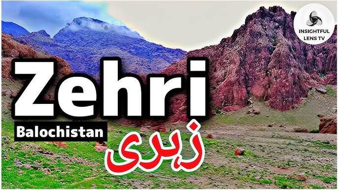
Koh-e-Zehri, rising from the rugged terrain of northern Khuzdar District, is more than just a mountain—it is a symbol of tribal identity, spiritual reverence, and natural grandeur. Located in Zehri Tehsil, approximately 80 kilometers north of Khuzdar city, this peak dominates the landscape and the cultural imagination of the Brahui-speaking communities that inhabit the region. For travelers seeking a blend of panoramic views, tribal heritage, and spiritual depth, Koh-e-Zehri offers a uniquely immersive experience.
Geographical and Cultural Context
Zehri Tehsil is the northernmost administrative subdivision of Khuzdar District, bordered by Kalat District to the north and Jhal Magsi to the east. The town of Zehri, which serves as the tehsil’s administrative center, has grown rapidly in recent years, with a population exceeding 70,000 as of 2023. Koh-e-Zehri lies just beyond the town’s outskirts, accessible via winding roads that climb through arid hills and scattered settlements.
The mountain itself is part of the broader Brahui Highlands, a region characterized by dry valleys, rocky outcrops, and sparse vegetation. Despite its harsh terrain, Koh-e-Zehri is revered by locals for its spiritual significance and its role in tribal history. Elders speak of the mountain as a place of meditation, tribal gatherings, and ancestral memory.
Historical and Tribal Significance
Koh-e-Zehri has long been associated with the Zehri tribe, one of the prominent Brahui-speaking clans in Balochistan. Oral traditions recount that tribal leaders once held councils on the mountain’s slopes, using its elevation as both a strategic vantage point and a symbolic seat of authority. The mountain is also linked to spiritual figures who are believed to have meditated in its caves and crevices, seeking divine insight and solitude.
While formal archaeological studies are limited, local accounts suggest that the area contains ancient burial sites and stone markers that may date back several centuries. These features add to the mountain’s mystique and reinforce its status as a cultural landmark.
Natural Features and Landscape
Koh-e-Zehri offers a dramatic landscape of jagged cliffs, narrow ridges, and sweeping views of the surrounding valleys. Key features include:
- Summit Plateau: A flat area near the peak used for tribal gatherings and spiritual reflection.
- Caves and Crevices: Natural shelters that have served as meditation spots and temporary dwellings.
- Wildlife: The area supports foxes, wild goats, and migratory birds, especially during cooler months.
- Flora: Sparse vegetation includes acacia trees, desert shrubs, and seasonal wildflowers.
The climb to the summit is moderately challenging, requiring sturdy footwear and basic hiking skills. The route is unmarked but well-known to local guides, who can lead visitors safely through the terrain.
Visitor Experience
Traveling to Koh-e-Zehri from Khuzdar takes approximately 2–2.5 hours by road. The journey passes through Zehri town, where travelers can stop for supplies, refreshments, and local guidance. From the town, a dirt track leads toward the mountain base, with the final ascent done on foot.
Visitors can hike, meditate, photograph the landscape, and engage with local communities. The experience is best suited for those interested in cultural immersion and nature exploration rather than conventional tourism.
- Best time to visit: October to March for cooler temperatures and clearer skies.
- Recommended gear: Hiking boots, sun protection, water bottle, camera, flashlight.
- Entry fees: None; local guides may charge a nominal fee.
- Mobile coverage: Available in Zehri town; limited near the mountain.
Camping is possible near the base, though facilities are minimal. Travelers should bring their own supplies and coordinate with local hosts for safety and logistics.
Photography Tips
Koh-e-Zehri offers striking visuals for photographers:
- Summit Views: Capture panoramic shots of Zehri Tehsil and surrounding valleys.
- Rock Textures: Focus on erosion patterns, cave entrances, and cliff faces.
- Tribal Portraits: With permission, document traditional attire and storytelling sessions.
- Sunrise and Sunset: Use natural light to highlight the mountain’s contours and shadows.
Drone photography may be permitted with local approval, especially for documenting the mountain’s scale and terrain.
Cultural Engagement
Visitors who engage with Zehri’s residents often gain deeper insights into Brahui culture. Sharing meals, listening to tribal stories, and participating in local rituals can transform a scenic hike into a meaningful cultural exchange. The mountain is often referenced in poetry, music, and oral history, making it a living symbol of identity and resilience.
Respect for local customs—such as modest dress, quiet behavior, and asking before taking photos—is essential. Travelers are encouraged to approach the site not just as tourists, but as guests in a deeply rooted cultural landscape.
Wadh Town
Wadh, located approximately 70 kilometers south of Khuzdar city along the N-25 National Highway, is the fourth-largest urban center in Khuzdar District and the administrative capital of Wadh Tehsil. With a population of over 26,000 as of 2023, Wadh is a vibrant town that blends tribal heritage, commercial activity, and archaeological intrigue. For travelers and researchers, it offers a unique window into the socio-economic and cultural dynamics of southern Balochistan.
Historical and Cultural Significance
Wadh and its surrounding mountainous terrain have been inhabited since prehistoric times. Archaeological remains—including cave paintings, burial sites, and ancient stone structures—attest to early human settlement in the region. Among the most notable are the Tharia Cave Paintings, located near the Pallimas Valley, which depict hunting scenes, tribal rituals, and symbolic motifs. These artworks are believed to date back thousands of years and offer insight into the spiritual and social life of early Baloch communities.
The town has historically served as a tribal stronghold for the Mengal and Sasoli tribes, both of which speak Brahui, a Dravidian language distinct from the Iranian languages spoken in neighboring regions. Despite successive waves of rule—from Arab empires to Persian dynasties, Afghan rulers, and British colonial authorities—the Brahui-speaking communities of Wadh have maintained a distinct cultural identity rooted in oral tradition, tribal governance, and spiritual practice.
Economic and Educational Landscape
Wadh’s economy is primarily based on agriculture and mineral extraction. The surrounding region is rich in natural resources, including barite, chromite, and limestone, which are mined and transported to other parts of Pakistan. Farming remains a vital livelihood, with crops such as wheat, dates, and vegetables cultivated using traditional irrigation systems.
The town is also emerging as an educational hub. Institutions such as the Government Boys High School, Government College Wadh, and a campus of the Lasbela University of Agriculture, Water and Marine Sciences provide secondary and tertiary education to students from across the tehsil. The Wadh Student Library serves as a local resource center, offering books, study space, and internet access.
Healthcare is anchored by the Civil Hospital Wadh, which provides basic medical services to residents of the town and surrounding villages.
Visitor Experience
Wadh is easily accessible via the N-25 Highway, which connects it to Khuzdar, Lasbela, and Karachi. The town’s central bazaar is a lively place to explore, with shops selling textiles, produce, and traditional crafts. Visitors can also explore nearby archaeological sites, interact with local tribes, and attend cultural events.
Key sites and experiences include:
- Tharia Cave Paintings: Located in the Pallimas Valley, these prehistoric artworks are accessible via a short hike from the main road.
- Wadh Bazaar: A bustling market offering local goods, street food, and handmade items.
- Tribal Villages: Engage with Mengal and Sasoli communities to learn about Brahui customs and oral history.
- Educational Institutions: Visit the university campus or library to understand local academic initiatives.
- Best time to visit: October to March for cooler weather and clearer skies.
- Recommended gear: Comfortable walking shoes, sun protection, water bottle, camera.
- Entry fees: None; some sites may require local guides.
- Mobile coverage: Available throughout the town.
Photography Tips
Wadh offers a mix of cultural and landscape photography opportunities:
- Cave Paintings: Use macro lenses and natural light to capture details.
- Market Scenes: Document daily life, colors, and textures of the bazaar.
- Tribal Portraits: With permission, photograph traditional attire and crafts.
- Architectural Details: Focus on stone structures, gates, and educational buildings.
Drone photography may be permitted with local approval, especially for capturing the layout of the town and surrounding hills.
Cultural Etiquette and Engagement
Visitors are encouraged to approach Wadh with respect and curiosity. The town’s residents are known for their hospitality, and engaging in conversation, sharing meals, and listening to stories can lead to meaningful exchanges. Modest dress, polite behavior, and asking before taking photos are essential.
Wadh’s cultural calendar includes tribal festivals, poetry gatherings, and religious observances, which offer opportunities for deeper immersion. Travelers interested in anthropology, linguistics, or regional politics will find Wadh to be a rich field site.
Pallimas Valley
Pallimas Valley, located in Wadh Tehsil of Khuzdar District, is a place where history whispers through stone and silence. Tucked between the rugged hills of southern Balochistan, this valley is home to some of the region’s most significant archaeological treasures—including the famed Tharia Cave Paintings and ancient inscriptions that date back to the Amri-Nal civilization. For travelers, researchers, and spiritual seekers, Pallimas offers a rare blend of prehistoric art, tribal heritage, and untouched natural beauty.
Geographical Overview
The valley lies just northeast of Wadh town, accessible via a rough but navigable road that winds through the Kunj and other hill torrents flowing from the surrounding mountains. Its coordinates place it within a transitional zone between the arid plains of Khuzdar and the fertile basins of Sindh. The terrain is marked by rocky outcrops, seasonal streams, and scattered vegetation, creating a dramatic backdrop for exploration.
Pallimas is relatively isolated, which has helped preserve its archaeological integrity. The valley’s remoteness also contributes to its spiritual ambiance, making it a favored site for meditation, reflection, and cultural immersion.
Archaeological and Historical Significance
Pallimas Valley is most famous for the Tharia Cave Paintings, a series of prehistoric artworks etched into the valley’s stone walls. These paintings depict hunting scenes, tribal rituals, and symbolic figures, offering insight into the beliefs and lifestyles of early inhabitants. Discovered and documented by Professor Aziz Kingrani, a renowned poet and historian, the site has drawn attention from archaeologists and cultural scholars across Pakistan.
In addition to the cave paintings, the valley contains ancient inscriptions and rock carvings that may date back to the Amri-Nal civilization—one of the earliest known cultures in South Asia. These inscriptions are believed to be proto-writing or symbolic communication, possibly used for spiritual or administrative purposes.
The valley’s archaeological richness makes it a key site for understanding the prehistoric development of Balochistan and its connections to neighboring regions such as Sindh and the Iranian plateau.
Natural Features
Beyond its historical value, Pallimas Valley is a haven of natural beauty. Key features include:
- Rock Shelters and Caves: Naturally formed spaces that house the cave paintings and offer shelter for hikers and researchers.
- Seasonal Streams: Fed by hill torrents, these streams create temporary pools and support local flora and fauna.
- Wildlife: The valley is home to foxes, wild goats, and migratory birds, especially during cooler months.
- Flora: Acacia trees, desert shrubs, and seasonal wildflowers dot the landscape.
The interplay of stone, light, and silence creates a meditative atmosphere that enhances the visitor experience.
Visitor Experience
Reaching Pallimas Valley from Wadh takes approximately 1–1.5 hours by jeep or motorbike. The route is unpaved and requires careful navigation, especially during the monsoon season when streams may flood. Local guides are essential for locating the cave paintings and understanding their context.
Visitors can hike, photograph, meditate, and engage with local communities. The experience is best suited for those interested in archaeology, anthropology, and spiritual travel.
- Best time to visit: October to March for cooler weather and clearer skies.
- Recommended gear: Hiking boots, sun protection, water bottle, flashlight, camera.
- Entry fees: None; donations to local preservation efforts are appreciated.
- Mobile coverage: Limited; offline maps and local coordination are recommended.
Camping is possible near the valley entrance, though facilities are minimal. Travelers should bring their own supplies and coordinate with local hosts for safety and logistics.
Photography Tips
Pallimas Valley offers exceptional opportunities for archaeological and landscape photography:
- Cave Art Close-Ups: Use macro lenses and natural light to capture details.
- Wide-Angle Landscapes: Document the valley’s scale and terrain.
- Texture Studies: Focus on rock surfaces, erosion patterns, and inscriptions.
- Golden Hour Shots: Capture the interplay of light and shadow across the valley.
Drone photography may be permitted with local approval, especially for documenting the layout of the valley and its archaeological features.
Cultural Engagement and Preservation
Visitors who engage with local communities often gain deeper insights into the valley’s significance. Elders share stories of tribal migrations, spiritual encounters, and ancestral rituals tied to the land. Respect for local customs—such as modest dress, quiet behavior, and asking before taking photos—is essential.
Despite its importance, Pallimas Valley faces threats from erosion, vandalism, and lack of formal protection. Scholars and NGOs have called for increased documentation, funding, and community involvement to preserve the site for future generations.
Kunj Hill Torrents
The Kunj Hill Torrents are a defining natural feature of Khuzdar District, flowing seasonally from the surrounding mountains into valleys such as Pallimas and Wadh. These torrents—locally known as Sailaba in Balochistan—are fast-moving streams formed by rainfall runoff on steep slopes. Though often overlooked, they play a critical role in shaping the region’s ecology, agriculture, and settlement patterns. For travelers and researchers, the Kunj torrents offer a dynamic lens into Balochistan’s environmental systems and traditional water management practices.
Geographical and Hydrological Overview
Originating in the hills north of Wadh and Pallimas Valley, the Kunj torrents descend rapidly during the monsoon season, carving temporary channels through the rocky terrain. These torrents are part of Pakistan’s broader hill torrent system, which covers approximately 55% of the country’s landmass and ranks as the second-largest irrigation system after the Indus Basin.
In Khuzdar, the torrents flow through dry riverbeds and seasonal nullahs, recharging groundwater and supporting agriculture in otherwise arid zones. Their unpredictable nature—ranging from gentle trickles to destructive floods—makes them both a blessing and a challenge for local communities.
Agricultural and Ecological Importance
The torrents are central to a traditional irrigation method known as spate irrigation, where floodwater is diverted into fields using earthen bunds and channels. This technique allows farmers to cultivate drought-resistant crops such as sorghum, pearl millet, and legumes. In regions like Wadh and Pallimas, the torrents also support mango and date orchards, which rely on seasonal moisture for growth.
Beyond agriculture, the torrents help recharge soil moisture, replenish aquifers, and sustain native vegetation. Wildlife—including foxes, wild goats, and migratory birds—depend on these water flows for survival during dry months. The torrents also shape the physical landscape, creating ravines, sediment beds, and erosion patterns that influence settlement and infrastructure.
Seasonal Behavior and Risks
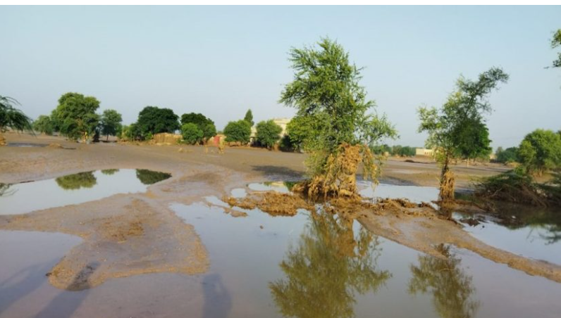
The Kunj torrents are most active during the monsoon season, typically from July to September. Heavy rainfall in the surrounding hills can trigger sudden and powerful flows, which may last for hours or days depending on precipitation levels. While these torrents are essential for agriculture, they also pose significant risks:
- Flash Floods: Rapid water accumulation can overwhelm local infrastructure, damage homes, and displace communities.
- Soil Erosion: Torrents strip away topsoil, reducing agricultural productivity and altering terrain.
- Livestock Losses: Animals caught in torrent paths may drown or suffer injuries.
- Water Contamination: Floodwaters can carry debris, waste, and pathogens, affecting drinking water sources.
The catastrophic floods of 2022, triggered by record-breaking monsoon rains, highlighted the destructive potential of hill torrents across Pakistan, including parts of Balochistan. These events underscore the need for effective watershed management and early warning systems.
Visitor Experience
For travelers, the Kunj Hill Torrents offer a unique opportunity to observe Balochistan’s natural hydrology in action. During the dry season, the torrent beds are accessible for hiking, photography, and geological study. During the monsoon, guided visits can reveal the torrents’ power and ecological impact—though safety precautions are essential.
- Best time to visit: October to March for dry exploration; July to September for observing active torrents (with caution).
- Recommended gear: Hiking boots, sun protection, water bottle, camera, waterproof bags.
- Entry fees: None; local guides may charge for tours.
- Mobile coverage: Available in nearby towns; limited in remote torrent zones.
Camping near torrent beds is possible during the dry season, but travelers should avoid these areas during active flow periods due to flood risk.
Photography Tips
The torrents offer dramatic visuals for nature and landscape photographers:
- Dry Beds: Capture erosion patterns, sediment layers, and geological textures.
- Active Flows: Use long exposure to document water movement and reflections.
- Wildlife: Photograph birds and animals near water sources.
- Sunrise/Sunset: Highlight the contours of the ravines and surrounding hills.
Drone photography may be permitted with local approval and is especially useful for mapping torrent paths and documenting flood impact.
Conservation and Management
Despite their importance, hill torrents like Kunj remain under-managed. Poor infrastructure, deforestation, and unplanned development have worsened flood risks and reduced agricultural efficiency. Experts advocate for:
- Watershed Management: Building check dams, contour bunds, and diversion channels.
- Community Training: Educating farmers on spate irrigation and flood preparedness.
- Environmental Protection: Reforestation and erosion control to stabilize terrain.
Local NGOs and academic institutions are beginning to study the torrents’ behavior and potential, but more investment is needed to harness their benefits while mitigating risks.
Khuzdar City Bazaar
Khuzdar City Bazaar is more than just a marketplace—it’s the living pulse of the city. Located in the heart of Khuzdar, this bustling commercial hub offers a sensory-rich experience of Balochistan’s culture, commerce, and community life. From traditional textiles and handmade jewelry to fresh produce and street food, the bazaar is where the city’s heritage meets its daily rhythm.
Layout and Atmosphere
The bazaar sprawls across several interconnected streets near the administrative center of Khuzdar. Narrow alleys branch off from the main thoroughfare, each specializing in different goods—from spices and fabrics to electronics and livestock. The air is filled with the scent of cardamom, grilled meat, and dust kicked up by rickshaws and foot traffic.
Vendors call out prices, children weave through crowds, and elders gather at tea stalls to discuss politics, poetry, and tribal affairs. The bazaar is especially lively in the mornings and late afternoons, when temperatures are more forgiving and shoppers flood the streets.
Cultural and Commercial Significance
Khuzdar Bazaar is a reflection of the city’s tribal diversity. Merchants from the Bizenjo, Mengal, Zehri, and Hasni communities operate stalls passed down through generations. Many products sold here are locally made, including:
- Balochi embroidery (Doch): Intricate hand-stitched patterns on shawls, dresses, and caps.
- Handwoven rugs and mats: Crafted from goat hair and dyed with natural pigments.
- Traditional jewelry: Silver bangles, nose rings, and necklaces with tribal motifs.
- Pottery and utensils: Made from local clay and often decorated with geometric designs.
The bazaar also serves as a distribution point for goods arriving via the N-25 highway, including produce from Sindh, electronics from Karachi, and textiles from Punjab. This convergence of regional trade makes Khuzdar Bazaar a vital economic engine for the district.
Women’s Bazaar
A standout feature of Khuzdar’s market scene is the Women’s Bazaar, a dedicated space where female entrepreneurs showcase and sell their handmade products. From embroidered dresses and jewelry to organic skincare and home décor, this market empowers local women and preserves traditional crafts.
The Women’s Bazaar is not only a commercial space but also a cultural initiative. It hosts workshops, exhibitions, and storytelling sessions that highlight the role of women in Balochistan’s economy and heritage. Visitors can engage with artisans, learn about their techniques, and support community-based enterprises.
Visitor Experience
Exploring Khuzdar Bazaar is a rewarding experience for travelers interested in culture, shopping, and street photography. Key tips include:
- Best time to visit: October to March for cooler weather; mornings and evenings for peak activity.
- Recommended gear: Comfortable walking shoes, sun protection, cash (most vendors don’t accept cards), camera.
- Safety tips: Keep valuables secure; avoid isolated alleys after dark.
- Local etiquette: Bargaining is expected; greet vendors respectfully and ask before taking photos.
Tea stalls and snack vendors offer local delicacies such as samosas, pakoras, and sweet jalebi. For a deeper experience, visitors can sit with locals over a cup of chai and hear stories about the city’s past and present.
Photography Tips
Khuzdar Bazaar is a vibrant subject for photographers:
- Street Scenes: Capture the movement, colors, and textures of daily life.
- Portraits: With permission, photograph artisans at work or elders in conversation.
- Product Close-Ups: Focus on embroidery, jewelry, and spices.
- Golden Hour: Use soft light to highlight the bazaar’s architectural details and market stalls.
Drone photography is not recommended due to crowd density and privacy concerns.
Preservation and Modernization
While Khuzdar Bazaar retains its traditional charm, modernization is slowly reshaping its infrastructure. Paved walkways, solar lighting, and waste management initiatives are being introduced to improve hygiene and accessibility. However, challenges remain, including overcrowding, lack of formal zoning, and limited digital integration.
Local authorities and NGOs are working to balance preservation with progress, ensuring that the bazaar remains a space for cultural continuity and economic growth.
Shrine of Baba-e-Baloch

The Shrine of Baba-e-Baloch, located in the heart of Khuzdar city, is one of the most spiritually significant landmarks in Balochistan. Revered across tribal lines, the shrine honors a legendary figure known as Baba-e-Baloch—often described as a symbol of unity, wisdom, and divine connection among the Baloch people. For pilgrims, historians, and cultural travelers, this site offers a profound experience of spiritual devotion and tribal heritage.
Historical and Spiritual Significance
While the exact origins of Baba-e-Baloch remain shrouded in oral tradition, local accounts describe him as a mystic and tribal elder who lived centuries ago and played a pivotal role in mediating disputes, guiding spiritual seekers, and fostering unity among Baloch tribes. His teachings emphasized humility, hospitality, and the pursuit of inner truth—values that continue to shape Baloch identity today.
The shrine is believed to be built over his burial site, and it has become a place of pilgrimage for people from across Balochistan and neighboring provinces. Devotees visit to offer prayers, seek blessings, and pay homage to a figure who transcends tribal divisions and political boundaries.
The shrine also serves as a cultural anchor, hosting gatherings, poetry recitations, and spiritual rituals that reinforce communal bonds and preserve oral history.
Architectural Features
The Shrine of Baba-e-Baloch is modest in scale but rich in symbolism. Key features include:
- Whitewashed Dome: A simple dome structure that marks the burial chamber, often adorned with green flags and prayer cloths.
- Prayer Courtyard: An open space where visitors gather for recitation, reflection, and communal meals.
- Grave Markers: Decorated with floral motifs, beads, and offerings left by devotees.
- Adjacent Mosque: A small prayer hall used for daily worship and special gatherings.
The architecture reflects the Sufi tradition—unpretentious, welcoming, and spiritually resonant. The shrine’s design encourages quiet contemplation and communal harmony.
Visitor Experience
Visiting the shrine is a deeply personal and communal experience. Pilgrims often arrive in groups, bringing food, flowers, and offerings. The atmosphere is peaceful, with soft recitations of poetry and dhikr (remembrance of God) echoing through the courtyard.
Local caretakers, known as khadims, maintain the site and guide visitors through its history and rituals. Travelers are welcome to observe or participate, provided they do so respectfully.
- Best time to visit: Year-round; especially during spiritual festivals and tribal gatherings.
- Recommended attire: Modest clothing; head covering for women.
- Entry fees: None; donations are appreciated.
- Accessibility: Easily reachable from Khuzdar city center by foot, rickshaw, or taxi.
- Mobile coverage: Strong; shrine is located within urban limits.
Photography is allowed in exterior areas, but visitors should seek permission before photographing the grave or worshippers.
Cultural and Tribal Relevance
The shrine plays a unique role in Khuzdar’s tribal landscape. It is one of the few places where members of different tribes—Bizenjo, Mengal, Zehri, Hasni, and others—gather without hierarchy or conflict. This unity is a testament to Baba-e-Baloch’s legacy and the spiritual values he embodied.
During special occasions, such as Urs (death anniversary commemorations), the shrine hosts poetry readings, music performances, and communal meals. These events attract visitors from across Balochistan and serve as platforms for cultural exchange and reconciliation.
The shrine is also referenced in local literature, music, and oral storytelling, reinforcing its role as a spiritual and cultural beacon.
Preservation and Community Engagement
The Shrine of Baba-e-Baloch is maintained by local communities and supported by donations. While it remains structurally sound, there is growing interest in formal documentation and preservation. Cultural organizations have proposed initiatives to:
- Digitally archive oral histories and poetry linked to the shrine.
- Improve infrastructure for pilgrims and visitors.
- Promote inter-tribal dialogue through spiritual gatherings.
Visitors can support these efforts by respecting the site, sharing their experiences, and contributing to preservation campaigns.
Climate and Weather in Khuzdar
Khuzdar experiences a subtropical desert climate (BWh), characterized by long, scorching summers, short and dry winters, and minimal rainfall throughout the year. Located at an elevation of approximately 674 meters (2,213 feet) above sea level, the city’s climate is shaped by its mountainous geography and proximity to arid zones. Understanding Khuzdar’s weather patterns is essential for planning travel, agricultural activities, and outdoor exploration.
Seasonal Overview
Khuzdar’s climate can be divided into three distinct seasons:
1. Summer (May to September)
This is the dominant season in Khuzdar, lasting over four months. Temperatures soar during this period, with June and July being the hottest months.
- Average high: 41.76°C (107.17°F) in July
- Average low: 27.74°C (81.93°F)
- Humidity: Drops to as low as 12–17%
- Sunshine: Up to 14.3 hours per day
The heat is intense and dry, making midday travel uncomfortable. Outdoor activities should be scheduled for early mornings or evenings. Travelers should stay hydrated and wear sun-protective clothing.
2. Winter (December to February)
Khuzdar’s winters are short but refreshing, offering the most pleasant conditions for tourism and fieldwork.
- Average high: 16.74°C to 18.89°C (62–66°F)
- Average low: 6.57°C to 9.37°C (44–49°F)
- Humidity: Rises to 30–38%
- Rainfall: February is the wettest month with 40.66 mm (1.6 inches)
This season is ideal for visiting archaeological sites, hiking, and attending cultural events. Light jackets are recommended for early mornings and evenings.
3. Transitional Months (March, April, October, November)
These months offer moderate temperatures and clearer skies, making them excellent for travel and photography.
- Average highs: 25°C to 36°C
- Average lows: 12°C to 22°C
- Humidity: Between 18–29%
- Rainfall: Minimal, with occasional showers in March and November
These months are favored by researchers and cultural tourists for their balance of comfort and accessibility.
Temperature Ranges
Khuzdar’s annual average temperature is 25.98°C (78.76°F), which is 5.09% higher than Pakistan’s national average. The city’s temperature extremes are notable:
| Month | Avg High (°C) | Avg Low (°C) |
|---|---|---|
| January | 16.74 | 6.57 |
| April | 31.73 | 20.94 |
| July | 41.76 | 27.74 |
| October | 30.66 | 17.32 |
The record high temperature is 47.16°C (116.89°F), while the record low is –3.08°C (26.46°F).
Precipitation Patterns
Khuzdar receives very little rainfall annually—just 13.29 mm (0.52 inches) spread across 26 rainy days. The city is dry 92.88% of the year, with most precipitation concentrated in:
- February: 40.66 mm
- March: 35.14 mm
- April: 20.92 mm
The driest month is September, with only 0.11 mm of rainfall. Flash floods can occur during rare heavy downpours, especially in low-lying areas near hill torrents.
Humidity and Wind
Humidity levels fluctuate seasonally:
- Winter: 30–38%
- Summer: 12–17%
- Annual average: 22.94%
Wind speeds are generally mild, averaging 2.6 km/h, with southwest winds dominating during summer. Dust storms are rare but possible during dry spells.
Sunshine and Solar Exposure
Khuzdar enjoys abundant sunshine year-round:
- Sunniest months: May to August (14+ hours/day)
- Least sunny months: December and January (8.8 hours/day)
This high solar exposure supports solar energy initiatives and makes Khuzdar ideal for outdoor photography and eco-tourism.
Climate-Related Travel Tips
- Hydration: Always carry water, especially during summer hikes or site visits.
- Clothing: Lightweight, breathable fabrics for summer; layered clothing for winter mornings.
- Timing: Avoid outdoor activities between 12–4 PM in summer.
- Health: Use sunscreen, wear sunglasses, and monitor for heat exhaustion symptoms.
- Flood Awareness: During monsoon months, check local advisories before traveling to valleys or hill torrent zones.
TL;DR: Khuzdar’s climate is hot, dry, and sunny most of the year, with brief, mild winters and minimal rainfall. October to March is the best window for travel, offering cooler temperatures and clearer skies. Summer months are extremely hot, with highs exceeding 40°C, so travelers should plan accordingly.
Best Time to Visit Khuzdar
Khuzdar’s climate and cultural rhythms make certain months more favorable for travel than others. With its subtropical desert climate, the city experiences extreme heat in summer and mild, dry winters. The best time to visit Khuzdar is between October and March, when temperatures are cooler, skies are clearer, and cultural events are in full swing.
Month-by-Month Travel Recommendations
| Month | Avg Temp (°C) | Rainfall | Travel Rating | Notes |
|---|---|---|---|---|
| January | 17 / 3.6 | Low | 🟡 Tolerable | Cold mornings; quiet season |
| February | 19.7 / 5.9 | Moderate | 🟡 Tolerable | Slightly warmer; some rain |
| March | 25.2 / 11.8 | Moderate | 🟢 Excellent | Ideal for outdoor activities |
| April | 30 / 17.7 | Low | 🟢 Excellent | Warm but pleasant |
| May | 35.7 / 23.6 | Low | 🟢 Excellent | Hot but dry; good visibility |
| June | 37.4 / 24.9 | Low | 🟡 Good | Start of peak heat |
| July | 36.9 / 24.8 | High | 🟡 Good | Monsoon risk; flash floods possible |
| August | 35.2 / 23.4 | Moderate | 🟢 Excellent | Lush landscapes post-rain |
| September | 33.6 / 21.3 | Low | 🟢 Excellent | Clear skies; comfortable temps |
| October | 30.3 / 16.4 | Very Low | 🟢 Excellent | Peak travel season begins |
| November | 24.7 / 10.7 | Very Low | 🟢 Excellent | Crisp air; cultural events |
| December | 19.9 / 5.6 | Low | 🟡 Tolerable | Cold nights; fewer tourists |
Festival and Event Calendar
Khuzdar’s tribal and spiritual heritage is reflected in its seasonal gatherings and cultural observances. Aligning your visit with these events can offer deeper immersion.
- Urs of Baba-e-Baloch (November): A spiritual gathering at the shrine, featuring poetry, music, and communal meals.
- Baloch Cultural Day (March 2): Celebrated across the district with traditional dress, music, and storytelling.
- Date Harvest Season (June–August): Visit Kech Valley and Naal for agritourism and orchard tours.
- Ramadan and Eid (dates vary): Spiritual observances and festive markets; Koh-e-Zehri and city mosques are especially active.
Note: Festival dates follow the Islamic lunar calendar and may shift annually. Confirm with local sources before planning.
Tourist Season Insights
- Peak Season (October–March): Ideal for sightseeing, hiking, and cultural engagement. Accommodation and transport are more available, but early booking is recommended.
- Shoulder Season (April, September): Warm but manageable; fewer crowds and good visibility.
- Low Season (May–August): Extreme heat and monsoon risks; suitable only for seasoned travelers or researchers with proper planning.
Travel Comfort Tips
- Clothing: Light layers for day and warmer options for night in winter. Breathable fabrics and sun protection in summer.
- Hydration: Essential year-round, especially during hikes or site visits.
- Timing: Plan outdoor activities for early morning or late afternoon.
- Health: Use sunscreen, carry basic medications, and avoid strenuous activity during peak heat.
Don’t Forget: If you’re aiming to explore Khuzdar’s archaeological sites, spiritual shrines, and natural valleys, October to March is your golden window. You’ll enjoy cooler temperatures, clearer skies, and access to cultural events that bring the city’s heritage to life.
Let me know when you’re ready to move on to the next section: Local Cuisine, where we’ll dive into traditional Balochi dishes and build a comprehensive table of 50 restaurants.
Local Cuisine and Restaurants in Khuzdar
Khuzdar’s culinary landscape is a flavorful reflection of Balochistan’s tribal traditions, seasonal agriculture, and spiritual simplicity. Meals here are hearty, slow-cooked, and deeply communal—often served on floor mats with shared platters and stories. Whether you’re savoring a smoky lamb sajji or sipping sweet Balochi chai, Khuzdar’s food scene offers a rich sensory experience rooted in heritage.
Traditional Balochi Dishes
Here are some of the most iconic dishes you’ll encounter in Khuzdar:
- Sajji: Whole lamb or chicken marinated in salt and roasted over open flames. Served with Kaak (stone-baked bread) or rice.
- Dumpukht: Slow-cooked meat sealed in a pot to retain juices and flavor.
- Kaak: Hard, flat bread baked on hot stones, often paired with meat or yogurt.
- Khaddi Kabab: Lamb stuffed and cooked underground, reserved for tribal gatherings.
- Tereeth: Roti pieces mixed with curry and Khrud (dry salty yogurt).
- Laandhi: Preserved meat cured over months and cooked with spices.
- Abgoosht: A lamb stew with beans and mashed vegetables, influenced by Persian cuisine.
- Roosh: Lamb joints served with broth and lentils.
- Butt o Maash: A mix of pulses, served sweet or salty.
- Chilaanch: A layered dessert made with kheer and jelly, eaten with roti and onions.
- Fried Fish Sajji: Coastal-style fish grilled with minimal seasoning.
Meals are typically accompanied by Lassi, Chai, and seasonal fruits like dates, pomegranates, and mangoes.
Culinary Experience
Dining in Khuzdar is informal and communal. Most restaurants offer floor seating, shared platters, and generous portions. Street food stalls serve quick bites like samosas, pakoras, and biryani. Vegetarian options are limited but available—usually lentil dishes, vegetable curries, and rice.
Travelers should carry cash, as most eateries do not accept cards. English is spoken at a basic level in hotels and larger restaurants, but learning a few Balochi phrases can enhance your experience.
Top Restaurants in Khuzdar
Here’s a curated list of 50 restaurants, cafes, and food stalls in Khuzdar, categorized by cuisine type, price range, and location.
| Name | Cuisine Type | Price Range | Location | Contact |
|---|---|---|---|---|
| Awaami Restaurant | Pakistani | $ | RHXW+JPG, Khuzdar | 0333-3156688 |
| Qadri Hotel | Traditional | $ | Rabia Road, Khuzdar | 0332-8084682 |
| Mashallah Hotel & Restaurant | Mixed Cuisine | $$ | M.A. Jinnah Road, Khuzdar | 0333-7974601 |
| Lal Qila Restaurant | BBQ/Traditional | $$ | Bolan Colony, Khuzdar | 0336-0355681 |
| Papa Gino’s | Fast Food | $ | Umer Farooq Chowk, Khuzdar | 0333-7337235 |
| Chamrock Hotel & Restaurant | Continental | $$ | RH7X+VF6, Khuzdar | 0333-2723821 |
| Hijra-e-Aswad | Pakistani | $$ | NH-25, Khuzdar | 0332-2777699 |
| Food Station | Snacks/Tea | $ | Cantonment Area, Khuzdar | 0323-2660066 |
| Super Shashan Hotel | BBQ | $$ | RCD Highway, Khuzdar | 0335-0325015 |
| Ayan Burger Point | Fast Food | $ | Eid Gah Road, Khuzdar | 0333-2278900 |
| Zimistan Restaurant & Cafe | Pakistani/Shisha | $$ | New Township Scheme, Khuzdar | 0335-7571394 |
| Al-Saadat Restaurant | Pakistani | $ | Central Khuzdar | — |
| Sharja Hotel & Restaurant | Mixed Cuisine | $$ | Bolan Colony, Khuzdar | — |
| Taj Mahal Hotel Chamrok | Traditional | $$ | Chamrok, Khuzdar | — |
| National Guest House & Rest. | Mixed Cuisine | $$ | RCD Hwy, Koshk, Khuzdar | 0333-7982285 |
| Baloch Biryani House | Biryani | $ | Near Market Square | — |
| Khuzdar Tikka Point | BBQ | $ | Near Eid Gah | — |
| Chahsar Chai Spot | Tea/Snacks | $ | Chahsar | — |
| Khuzdar Ice Cream Café | Desserts | $ | Near City Park | — |
| Kech Curry House | Curry Dishes | $ | Malikabad | — |
| Khuzdar Fried Chicken | Fast Food | $ | Main Road | — |
| Khuzdar Veg Corner | Vegetarian | $ | Near Market Square | — |
| Khuzdar Food Street | Street Food | $ | Central Bazaar | — |
| Khuzdar Pizza Point | Fast Food | $$ | Near College Road | — |
| Khuzdar Family Restaurant | Mixed Cuisine | $$ | Near City Hospital | — |
| Khuzdar Breakfast Café | Breakfast | $ | Near Market Square | — |
| Khuzdar Grill & Dine | BBQ/Continental | $$ | Near Commissioner Road | — |
| Khuzdar Tandoor Express | Breads/BBQ | $ | Near Bus Terminal | — |
| Khuzdar Cultural Café | Traditional | $$ | Near Nazim’s Mosque | — |
| Khuzdar Mango Orchard Café | Organic/Local | $$ | Naal Valley | — |
| Khuzdar Student Food Center | Fast Food | $ | Near College Road | — |
| Khuzdar Baloch Cuisine House | Traditional | $$ | Near Shahi Tump | — |
| Khuzdar Continental Inn | Continental | $$ | Near University Campus | — |
| Khuzdar BBQ Express | BBQ | $$ | Koshk | — |
| Khuzdar Family Tandoor | Breads/BBQ | $ | Near Railway Quarters | — |
| Khuzdar Orchard Inn | Farm Stay Dining | $$ | Kech Valley | — |
| Khuzdar Tea & Talk Café | Tea/Desserts | $ | Near City Library | — |
| Khuzdar Veg Delight | Vegetarian | $ | Near College Road | — |
| Khuzdar Curry Junction | Curry Dishes | $ | Near Absor Town | — |
| Khuzdar Baloch Food Plaza | Mixed Cuisine | $$ | Near University Road | — |
| Khuzdar Eco Café | Organic/Local | $$ | Near Kech River | — |
| Khuzdar Tandoori House | Breads/BBQ | $ | Near Shahi Tump | — |
| Khuzdar Street Food Hub | Mixed Snacks | $ | Central Bazaar | — |
| Khuzdar Fish Fry | Seafood | $ | Near Riverbank | — |
| Khuzdar Cultural Inn | Traditional | $$ | Near Shahi Tump | — |
| Khuzdar Park Café | Continental | $$ | Near City Park | — |
| Khuzdar Orchard Stay | Farm Dining | $$ | Kech Valley | — |
| Khuzdar Comfort Inn | Mixed Cuisine | $$ | Near City Hospital | — |
Accommodation in Khuzdar
Khuzdar offers a modest but growing range of accommodation options, from budget guesthouses to mid-range hotels. While luxury resorts are not yet part of the city’s landscape, travelers can find clean, comfortable, and locally managed places to stay. Most hotels cater to domestic tourists, researchers, and business visitors, with basic amenities and personalized service.
Types of Accommodation
- Budget Guesthouses: Ideal for solo travelers, students, and researchers. These offer shared rooms, local meals, and basic facilities.
- Mid-Range Hotels: Suitable for families and professionals. These provide air conditioning, private bathrooms, and room service.
- Community Lodges: Located near cultural sites and orchards, offering immersive experiences with local hosts.
- Business Hotels: Positioned near administrative centers and transport hubs, with meeting rooms and Wi-Fi.
Most hotels in Khuzdar operate on a walk-in basis, though phone reservations are recommended during peak seasons. Online booking platforms such as , , and list a handful of verified properties.
Top Hotels in Khuzdar
| Hotel Name | Price Category | Amenities | Location | Booking Tips |
|---|---|---|---|---|
| Rizwan Hotel | $$ | AC, Wi-Fi, Room Service | Central Khuzdar | Book early during festivals |
| Tariq Balochistan Hotel | $$ | Parking, Restaurant, Laundry | Near RCD Highway | Ask for upper-floor rooms |
| SAARC Hotel | $$ | AC, Private Baths, Parking | Bolan Colony | Ideal for business travelers |
| Al Mustafa Hotel | $ | Basic Rooms, Local Meals | Near Eid Gah | Good for short stays |
| Al Saudia Hotel | $ | Fan Rooms, Shared Bathrooms | Near Market Square | Budget-friendly option |
| Chamrock Hotel | $$ | Garden, Wi-Fi, Breakfast | Near City Park | Popular with researchers |
| Hijra-e-Aswad Hotel | $$ | AC, Restaurant, Conference Room | NH-25 Corridor | Business-friendly |
| Lal Qila Hotel | $$ | Family Rooms, Room Service | Bolan Colony | Ask for group discounts |
| Mashallah Hotel | $ | Basic Rooms, Local Cuisine | Rabia Road | Good for transit travelers |
| Qadri Hotel | $ | Fan Rooms, Shared Kitchen | Near Railway Quarters | Quiet location |
| National Guest House | $$ | Wi-Fi, Breakfast, Laundry | Koshk | Centrally located |
| Taj Mahal Hotel | $$ | AC, Restaurant, Parking | Chamrok | Scenic views available |
| Sharja Hotel | $$ | AC, TV, Parking | Bolan Colony | Ask for quiet rooms |
| Papa Gino’s Lodge | $ | Shared Rooms, Local Meals | Umer Farooq Chowk | Affordable for students |
| Food Station Guest House | $$ | Garden, Organic Meals | Cantonment Area | Ideal for eco-tourists |
| Super Shashan Hotel | $$ | AC, Room Service, Wi-Fi | RCD Highway | Convenient for road travelers |
| Ayan Burger Point Stay | $ | Parking, TV, Breakfast | Eid Gah Road | Budget-friendly |
| Zimistan Hotel | $$ | AC, Restaurant, Laundry | Township Scheme | Good for long stays |
| Khuzdar Residency | $$ | Family Suites, Wi-Fi | Near City Hospital | Popular with families |
| Balochistan Inn | $$ | Meeting Rooms, Wi-Fi | Near Commissioner Road | Ideal for professionals |
| Khuzdar Orchard Lodge | $$ | Scenic Views, Garden | Naal Valley | Best during harvest season |
| Khuzdar Youth Hostel | $ | Dorms, Shared Kitchen | Near College Road | Ideal for backpackers |
| Khuzdar Eco Lodge | $$ | Solar Power, Organic Meals | Kech Valley | Sustainable travel option |
| Khuzdar Heritage Stay | $$ | Cultural Decor, Local Cuisine | Near Shahi Tump | Great for cultural immersion |
| Khuzdar Transit Inn | $ | Basic Rooms, Tea Service | Near Bus Terminal | Good for overnight stays |
| Khuzdar Comfort Hotel | $$ | AC, Wi-Fi, Room Service | Near City Library | Popular with families |
| Khuzdar Boutique Hotel | $$ | Stylish Decor, Wi-Fi | Near Market Square | Ask for corner rooms |
| Khuzdar Sunset Lodge | $$ | Scenic Views, Garden | Near Mirani Dam | Best at sunset |
| Khuzdar Central Hotel | $$ | Wi-Fi, Breakfast, Laundry | Central Bazaar | Centrally located |
| Khuzdar Valley Inn | $$ | Garden, Local Cuisine | Kech Valley | Ideal for nature lovers |
| Khuzdar Student Lodge | $ | Shared Rooms, Study Area | Near College Road | Good for academic visits |
| Khuzdar Park Hotel | $$ | AC, Garden, Wi-Fi | Near City Park | Near public park |
| Khuzdar Riverside Stay | $$ | River Views, Breakfast | Near Kech River | Scenic and peaceful |
| Khuzdar Cultural Inn | $$ | Traditional Decor, Local Food | Near Shahi Tump | Great for heritage travelers |
| Khuzdar Budget Inn | $ | Basic Rooms, Shared Bathroom | Near Bus Terminal | Affordable and clean |
| Khuzdar Mango Orchard Stay | $$ | Garden, Organic Meals | Naal Valley | Eco-friendly option |
| Khuzdar Family Inn | $$ | Family Suites, Wi-Fi | Near City Hospital | Good for long stays |
| Khuzdar Guest Residency | $$ | AC, Parking, Breakfast | Near Market Square | Book early during festivals |
| Khuzdar Orchard Retreat | $$ | Farm Stay, Local Cuisine | Kech Valley | Best during harvest season |
| Khuzdar Comfort Residency | $$ | AC, Wi-Fi, Room Service | Bolan Colony | Popular with families |
| Khuzdar Tandoor Guesthouse | $ | Shared Rooms, Local Meals | Near Railway Quarters | Budget option |
| Khuzdar Business Lodge | $$ | Meeting Rooms, Wi-Fi | Near Commissioner Road | Ideal for professionals |
| Khuzdar Family Stay | $$ | Family Rooms, Kitchenette | Near City Hospital | Long-stay friendly |
| Khuzdar Backpacker Inn | $ | Dorms, Shared Lounge | Near College Road | Budget travel option |
| Khuzdar Orchard Inn | $$ | Farm Views, Local Breakfast | Kech Valley | Book during harvest |
| Khuzdar Park Residency | $$ | AC, Garden, Wi-Fi | Near City Park | Near public park |
| Khuzdar Mango Grove Lodge | $$ | Farm Stay, Organic Meals | Naal Valley | Ideal for eco-tourists |
| Khuzdar Guest House | $ | Basic Rooms, Local Food | Near Market Square | Good for solo travelers |
Frequently Asked Questions (FAQs)
1. Do I need a No Objection Certificate (NOC) to visit Khuzdar?
Yes, foreign travelers require a No Objection Certificate (NOC) to visit Balochistan, including Khuzdar. This document is separate from your tourist visa and must be arranged in advance, typically through a registered travel agency. Pakistani citizens do not require an NOC.
2. Is Khuzdar safe for tourists?
Khuzdar is generally safe for domestic travelers and guided foreign visitors. However, due to regional sensitivities, foreign tourists may be accompanied by security escorts and are advised to follow government guidelines strictly. Avoid traveling alone in remote areas and always inform local authorities or hosts of your itinerary.
3. What is the best way to reach Khuzdar?
Khuzdar is accessible via the N-25 National Highway, which connects it to Karachi, Quetta, and Chaman. There is no commercial airport in Khuzdar; the nearest airports are in Karachi and Quetta. From there, travelers continue by road. Train service is not available directly to Khuzdar.
4. What languages are spoken in Khuzdar?
The primary languages are Brahui and Balochi, with Urdu used for administration and education. English is spoken at a basic level in hotels and government offices. Learning a few local phrases can enhance your experience.
5. What should I wear in Khuzdar?
Modest clothing is recommended. Men typically wear shalwar kameez, while women should wear loose-fitting clothes and a headscarf, especially when visiting religious sites or rural areas. Respect for local customs is appreciated.
6. Are there ATMs and mobile networks available?
Yes, Khuzdar has ATMs in central areas, though cash is preferred in most markets and restaurants. Mobile networks such as Jazz, Zong, and Ufone operate in the region, but coverage may be limited in remote valleys.
7. Can I use credit cards?
Credit card acceptance is limited. Most transactions are conducted in cash. Larger hotels and business centers may accept cards, but it’s best to confirm in advance.
8. What are the cultural norms I should be aware of?
Respect for elders, modest dress, and polite behavior are valued. Avoid public displays of affection, loud behavior, or photographing people without permission. Hospitality is central to Baloch culture—accepting tea or snacks is considered courteous.
9. What kind of power outlets are used?
Pakistan uses Type C and Type D power sockets. Voltage is 230V, and frequency is 50Hz. Travelers should carry universal adapters and voltage converters if needed.
10. Is Khuzdar suitable for solo travelers?
Yes, especially for domestic tourists and researchers. Solo travelers should stay in central areas, avoid isolated routes, and connect with local guides or hosts for deeper engagement.
11. Can I visit religious sites as a non-Muslim?
Yes, but with respect and discretion. Sites like the Shrine of Baba-e-Baloch welcome visitors outside of prayer times. Always ask for permission before entering prayer halls or taking photographs.
12. What are the emergency contacts in Khuzdar?
- Police: 15
- Ambulance: 1122
- Civil Hospital Khuzdar: Located near Commissioner Road
- Local Administration Office: Available in Bolan Colony
Travelers should also register with their embassy or consulate if staying for an extended period.t


